Tropical cyclones
Climate Wikience provides several ways to explore tropical cyclones.
-
interactively nagivate using auxiliary data like wind speed or cloud properties
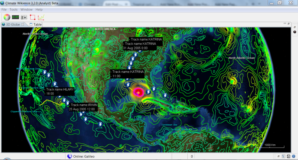
Hurricane Katrina track and CFSR wind speed at 10 meters above surface, 28 of August, 2005 (the date near the hurricane peak strength)
-
Wind speed swaths (footprints) for tropical cyclones
Use for risk assessment and other advanced studies
Watch the interactive exploration of Hurricane Iniki wind swath using Climate Wikience. Iniki stroke Hawaii in 1992 being the 3rd costliest Pacific hurricane on history (estimated cost: $3.03 billion for 2015).
Archives
- February 2022 (1)
- May 2015 (1)
- April 2015 (1)
- February 2015 (8)
- January 2015 (4)
- November 2014 (5)
- October 2014 (4)
- May 2014 (4)
Tags
- Air pollution (1)
- Air pollution risk (1)
- AMSR-E (2)
- Aura Satellite (1)
- CFSR (3)
- Cloud top pressure (1)
- Cloud top temperature (1)
- Greeness fraction (1)
- Hurricane Katrina (5)
- IBTrACS (1)
- isolines (4)
- LAI (1)
- MERRA (1)
- MODIS (2)
- Nitrogen dioxide (2)
- OMI (2)
- QuikSCAT (2)
- RWikience (1)
- SSMIs (2)
- Time series (2)
- TMI (2)
- Wind speed (2)


