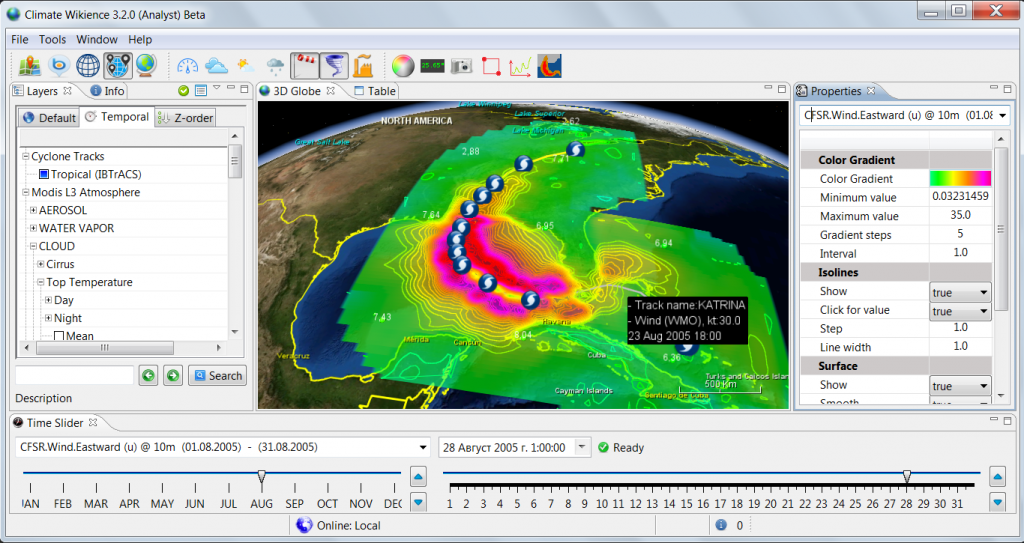
Tropical cyclone wind swath generation by Climate Wikience
The figure above shows a wind speed “swath” generated by ChronosServer for hurricane Katrina (August, 2005) using CFSR wind speed for 10 meters above the surface. For each date during the hurricane, ChronosServer extracts 12°×12° region for eastward (u) and northward (v) wind components around a hurricane center, calculates wind speed, uses bicubic spline interpolation to derive regular 0.25° × 0.25° grid from original Gaussian grid (about 0.5° × 0.3°), overlays regions obtained for each track center and selects maximum wind speed for a grid point among intersecting regions.
Archives
- February 2022 (1)
- May 2015 (1)
- April 2015 (1)
- February 2015 (8)
- January 2015 (4)
- November 2014 (5)
- October 2014 (4)
- May 2014 (4)
Tags
- Air pollution (1)
- Air pollution risk (1)
- AMSR-E (2)
- Aura Satellite (1)
- CFSR (3)
- Cloud top pressure (1)
- Cloud top temperature (1)
- Greeness fraction (1)
- Hurricane Katrina (5)
- IBTrACS (1)
- isolines (4)
- LAI (1)
- MERRA (1)
- MODIS (2)
- Nitrogen dioxide (2)
- OMI (2)
- QuikSCAT (2)
- RWikience (1)
- SSMIs (2)
- Time series (2)
- TMI (2)
- Wind speed (2)


